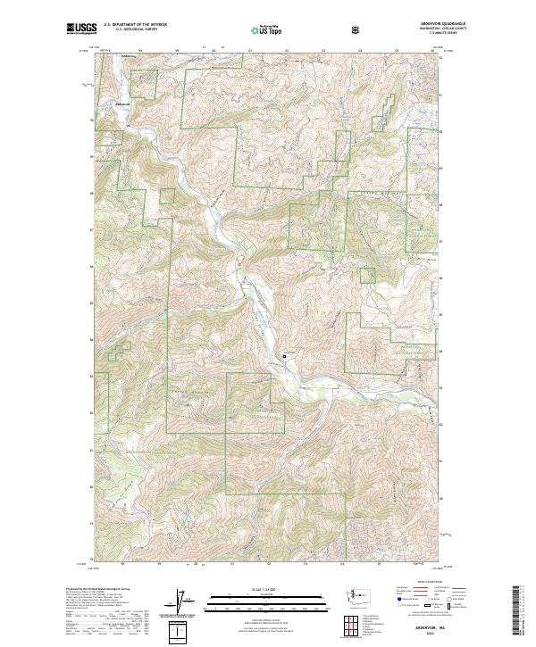
2023 Map of Ardenvoir
USGS Topo · Published 2023About this map
Ardenvoir serves as the central hub of this mountain landscape, situated at the confluence of the Mad River and the Entiat River. The settlement pattern follows the narrow floor of the Entiat Valley, where early infrastructure like the Entiat Ditch and Co HWY 19 trace the water’s edge beneath the high peaks of the Entiat Mountains and Chelan Mountains. This area is characterized by its complex drainage network, including Roaring Creek and numerous canyons such as Steliko Canyon and Dinkelman Canyon.
Find a feature on this map
60 named features on this map. Tap any name to fly to it.
Don’t see what you’re looking for? This feature index may not catch every label — zoom into the map to look around manually.
Map Details
Editions of this 2023 Ardenvoir Map
This is the sole edition of this map. No revisions or reprints were ever made.
Other maps of this area

1901 · Chelan
USGS Topo · 1:125,000

1957 · Wenatchee
USGS Topo · 1:250,000

1968 · Orondo
USGS Topo · 1:24,000

1968 · Entiat
USGS Topo · 1:24,000
1968 · Cashmere
USGS Topo · 1:24,000

1968 · Tyee Mtn.
USGS Topo · 1:24,000

1968 · Ardenvoir
USGS Topo · 1:24,000

1968 · Baldy Mtn
USGS Topo · 1:24,000
1968 · Chumstick Mtn
USGS Topo · 1:24,000

1968 · Winesap
USGS Topo · 1:24,000