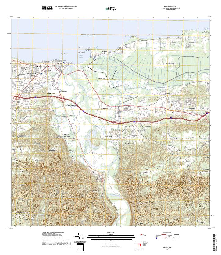
2024 Map of Arecibo
USGS Topo · Published 2024About this map
The Río Grande de Arecibo winds through a landscape of coastal wetlands and urban development, defining the geography of this Puerto Rican municipality. The northern shoreline is marked by the Atlantic Ocean and distinctive geological formations like Punta Morrillos and Roca Cocinera. Inland, the map reveals a dense network of neighborhoods such as San Luis and Las Mercedes, alongside significant institutional hubs like the Centro Judicial de Arecibo and the National University College Arecibo.
Find a feature on this map
61 named features on this map. Tap any name to fly to it.
Don’t see what you’re looking for? This feature index may not catch every label — zoom into the map to look around manually.
Map Details
Editions of this 2024 Arecibo Map
This is the sole edition of this map. No revisions or reprints were ever made.
Other maps of this area

1938 · Camuy
USGS Topo · 1:20,000

1942 · Arecibo
USGS Topo · 1:30,000

1942 · Camuy
USGS Topo · 1:30,000

1942 · Barceloneta
USGS Topo · 1:30,000

1943 · Utuado NE
USGS Topo · 1:10,000

1946 · Barceloneta
USGS Topo · 1:30,000

1946 · Utuado
USGS Topo · 1:30,000

1946 · Bayaney
USGS Topo · 1:30,000

1946 · Arecibo
USGS Topo · 1:30,000

1946 · Florida
USGS Topo · 1:30,000