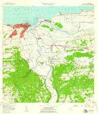
1957 Map of Arecibo
USGS Topo · Published 1961About this map
Arecibo stands as a prominent coastal hub at the mid-century, where the Río Grande de Arecibo meets the Atlantic Ocean. The urban core is flanked by the distinct neighborhoods of Miramar and San Felipe, while the industrial strength of the era is evident in the Central Cambalache and Central Los Caños sugar mills. The landscape is defined by the massive drainage project of the Ciénaga Tiburones and the meandering paths of the Río Tanamá and Río Santiago.
Find a feature on this map
98 named features on this map. Tap any name to fly to it.
Don’t see what you’re looking for? This feature index may not catch every label — zoom into the map to look around manually.
Map Details
Editions of this 1957 Arecibo Map
This is the sole edition of this map. No revisions or reprints were ever made.
Other maps of this area

1938 · Camuy
USGS Topo · 1:20,000

1942 · Arecibo
USGS Topo · 1:30,000

1942 · Camuy
USGS Topo · 1:30,000

1942 · Barceloneta
USGS Topo · 1:30,000

1943 · Utuado NE
USGS Topo · 1:10,000

1946 · Barceloneta
USGS Topo · 1:30,000

1946 · Utuado
USGS Topo · 1:30,000

1946 · Bayaney
USGS Topo · 1:30,000

1946 · Arecibo
USGS Topo · 1:30,000

1946 · Florida
USGS Topo · 1:30,000
Featured Places
- Arecibo, Arecibo
- Reparto Capitolio, Arecibo
- Villa Vélez, Arecibo
- Sector Pueblo de Paja, Arecibo
- Ballajá, Arecibo