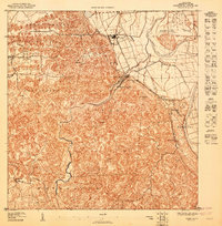
1947 Map of Arecibo SO
USGS Topo · Published 1947About this map
Central Los Caños stands as a focal point of industrial activity north of the karst-heavy terrain in this mid-century topographic study. The landscape is defined by the winding course of the Río Grande de Arecibo and the Río Tanamá, which carve through the prominent limestone mogotes that characterize the barrios of Tanamá, Dominguito, and Carreras. This survey, based on topography from 1940 to 1943, reveals a network of small settlements and neighborhood centers such as La Guinea and La Esperanza connected by a maturing system of roads and trails.
Find a feature on this map
19 named features on this map. Tap any name to fly to it.
Don’t see what you’re looking for? This feature index may not catch every label — zoom into the map to look around manually.
Map Details
Editions of this 1947 Arecibo SO Map
This is the sole edition of this map. No revisions or reprints were ever made.
Other maps of this area

1938 · Camuy
USGS Topo · 1:20,000

1942 · Arecibo
USGS Topo · 1:30,000

1942 · Camuy
USGS Topo · 1:30,000

1943 · Utuado NE
USGS Topo · 1:10,000

1946 · Utuado
USGS Topo · 1:30,000

1946 · Bayaney
USGS Topo · 1:30,000

1946 · Arecibo
USGS Topo · 1:30,000
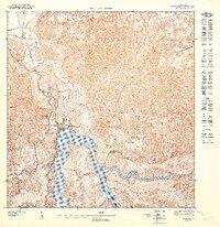
1947 · Utuado NE
USGS Topo · 1:10,000
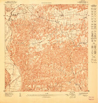
1947 · Arecibo SE
USGS Topo · 1:10,000

1947 · Utuado NO
USGS Topo · 1:10,000
Featured Places
- Villa Vélez, Arecibo
- Sector Pueblo de Paja, Arecibo
- Central Los Caños, Arecibo
- Sector Boquerón, Arecibo
- Sector La Guinea, Arecibo