2024 Map of Argenta
USGS Topo · Published 2024About this map
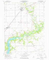
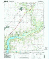
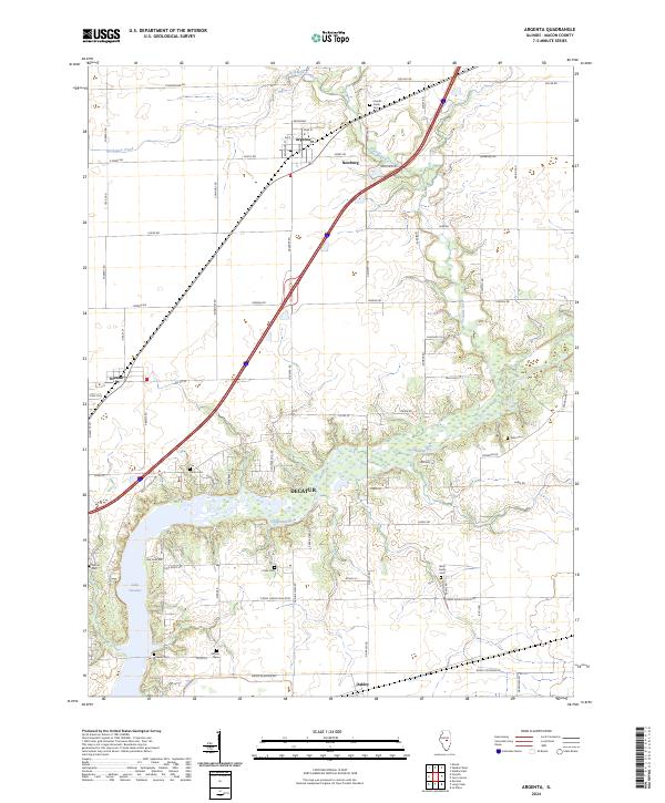
Decatur and its northeast environs are anchored by the expansive waters of Lake Decatur and the winding course of the Sangamon River. The village of Argenta serves as a primary hub in the northern section of the map, situated near the intersection of Broadway and Main St. This modern landscape is characterized by a dense network of country roads such as the Cerro Gordo Blacktop and Jordan Rd, which connect the smaller settlements of Newburg and Oreana. For those researching local lineages, the map is remarkably dense with burial sites, including the Friends Creek Cem to the north and the Ritchie Cem and Wheeler Cem near the southern boundary. These cemeteries, alongside landmarks like the Union Cem, offer precise points of interest for genealogists tracing the established families of Macon County.
Find a feature on this map
50 named features on this map. Tap any name to fly to it.
Don’t see what you’re looking for? This feature index may not catch every label — zoom into the map to look around manually.
Map Details
Editions of this 2024 Argenta Map
This is the sole edition of this map. No revisions or reprints were ever made.