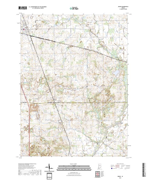
2022 Map of Argos
USGS Topo · Published 2022About this map
The town of Argos serves as the primary hub of this north-central Indiana landscape, where the grid of Marshall St and N Michigan St meets a surrounding countryside defined by extensive drainage management. This 2022 survey documents an agricultural economy intricately tied to the land's hydrology, visible through a dense network of man-made waterways like Hooker Ditch, Albright Ditch, and Warner Ditch. These features illustrate the transformation of local wetlands into productive acreage over time.
Find a feature on this map
90 named features on this map. Tap any name to fly to it.
Don’t see what you’re looking for? This feature index may not catch every label — zoom into the map to look around manually.
Map Details
Editions of this 2022 Argos Map
This is the sole edition of this map. No revisions or reprints were ever made.
Other maps of this area

1953 · Chicago
USGS Topo · 1:250,000

1957 · Chicago
USGS Topo · 1:250,000

1957 · Inwood
USGS Topo · 1:24,000

1957 · Plymouth
USGS Topo · 1:24,000

1958 · Bourbon
USGS Topo · 1:24,000

1959 · Mentone
USGS Topo · 1:24,000

1962 · Pershing
USGS Topo · 1:24,000
1962 · Akron
USGS Topo · 1:24,000

1962 · Argos
USGS Topo · 1:24,000
1962 · Rochester
USGS Topo · 1:24,000