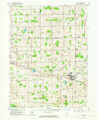
1962 Map of Akron
USGS Topo · Published 1964About this map
Akron and the surrounding townships of Henry, Franklin, and Newcastle define this section of northern Indiana in the early 1960s. The landscape is heavily shaped by agricultural infrastructure, evidenced by an extensive network of drainage projects such as the Eaton Busenburg Ditch, Leininger Ditch, and Curtis Ditch. These waterways weave between glacial features like Town Lake, Keesey Lake, and Barr Lake, illustrating the transition from natural wetlands to managed farmland. The Erie-Lackawanna railroad cuts a diagonal path through the region, connecting the small communities of Athens and Akron. Local life is anchored by traditional landmarks, including Olive Bethel Ch, Bethlehem Ch, and the Ioof Cem. The presence of an Old Railroad Grade near Beaver Dam reveals the shifting patterns of transportation as the steam era gave way to modern thoroughfares like 800 South Road.
Find a feature on this map
47 named features on this map. Tap any name to fly to it.
Don’t see what you’re looking for? This feature index may not catch every label — zoom into the map to look around manually.
Map Details
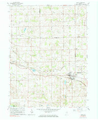
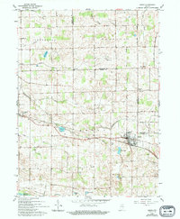
Editions of this 1962 Akron Map
3 editions found
Other maps of this area

1953 · Fort Wayne
USGS Topo · 1:250,000

1953 · Chicago
USGS Topo · 1:250,000

1953 · Danville
USGS Topo · 1:250,000

1953 · Muncie
USGS Topo · 1:250,000

1955 · Danville
USGS Topo · 1:250,000

1956 · Muncie
USGS Topo · 1:250,000

1956 · Danville
USGS Topo · 1:250,000

1956 · Fort Wayne
USGS Topo · 1:250,000

1957 · Chicago
USGS Topo · 1:250,000

1959 · Mentone
USGS Topo · 1:24,000