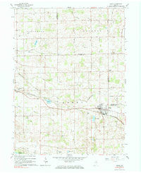
1962 Map of Akron
USGS Topo · Published 1984About this map
Akron serves as the primary hub of activity in this northern Indiana landscape, where the Erie-Lackawanna railroad cuts a diagonal path through the glacial terrain. The town's grid is dense with local landmarks, including a High School and the IOOF Cem, while the surrounding countryside is defined by an extensive network of drainage ditches such as Curtis Ditch and Leininger Ditch. These man-made channels highlight the historical effort to transform the marshy pockets of Fulton and Kosciusko counties into productive farmland.
Find a feature on this map
46 named features on this map. Tap any name to fly to it.
Don’t see what you’re looking for? This feature index may not catch every label — zoom into the map to look around manually.
Map Details
Editions of this 1962 Akron Map
3 editions found
Other maps of this area

1953 · Fort Wayne
USGS Topo · 1:250,000

1953 · Chicago
USGS Topo · 1:250,000

1953 · Danville
USGS Topo · 1:250,000

1953 · Muncie
USGS Topo · 1:250,000

1955 · Danville
USGS Topo · 1:250,000

1956 · Muncie
USGS Topo · 1:250,000

1956 · Danville
USGS Topo · 1:250,000

1956 · Fort Wayne
USGS Topo · 1:250,000

1957 · Chicago
USGS Topo · 1:250,000

1959 · Mentone
USGS Topo · 1:24,000