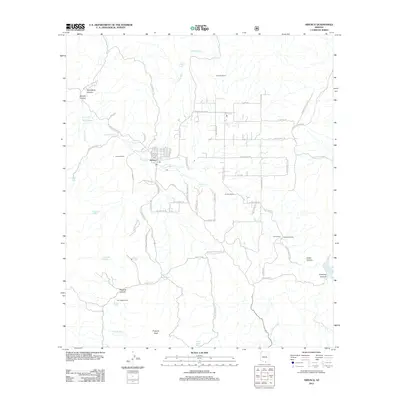
2012 Map of Arivaca
USGS Topo · Published 2012About this map
The town of Arivaca serves as the focal point for this high-desert landscape, where a grid of small streets and a Po mark the local center of community. Water management is central to the area's geography, evidenced by a network of drainage systems like Arivaca Cr and Amigo Wash, alongside numerous man-made water catchments such as Caviglia Tank and Mule Shoe Tank. These features, combined with isolated water sources like Watergate Spring, highlight the essential infrastructure required for ranching and survival in the arid terrain south of Tucson.
Find a feature on this map
79 named features on this map. Tap any name to fly to it.
Don’t see what you’re looking for? This feature index may not catch every label — zoom into the map to look around manually.
Map Details
Editions of this 2012 Arivaca Map
This is the sole edition of this map. No revisions or reprints were ever made.
Other maps of this area

1920 · Arivaca
USGS Topo · 1:125,000

1921 · Old Glory
USGS Topo · 1:125,000

1939 · Tubac
USGS Topo · 1:62,500

1941 · Arivaca
USGS Topo · 1:62,500

1942 · Ruby
USGS Topo · 1:62,500

1942 · Oro Blanco
USGS Topo · 1:62,500

1943 · Arivaca
USGS Topo · 1:62,500

1943 · Old Glory
USGS Topo · 1:125,000

1943 · Tubac
USGS Topo · 1:62,500

1944 · Oro Blanco
USGS Topo · 1:62,500