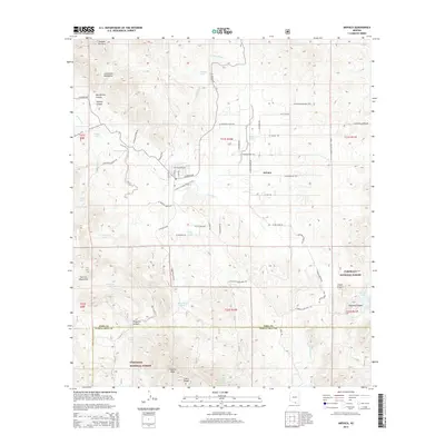
2014 Map of Arivaca
USGS Topo · Published 2014About this map
Arivaca serves as the central hub of this desert landscape, where the seasonal waters of Arivaca Cr and Amigo Wash meet. The settlement is surrounded by a network of ranching and nature routes, including the Arivaca Cienega Nature Trail and the Mustang Trail, which wind through the foothills of the Las Guijas Mountains to the north and the San Luis Mountains to the west. The southern portion of the map is dominated by the northern reaches of the Coronado National Forest, where the terrain rises sharply toward Fraguita Peak and the Cobre Ridge. This area transitions from flat desert washes like Oro Blanco Wash to steep-walled features such as McCafferty Canyon and Chimney Canyon. Important water sources for the region's ranching history are scattered throughout, represented by numerous tanks and springs like Stopes Tank, Caviglia Tank, and Watergate Spring, culminating at Arivaca Lake in the southeast.
Find a feature on this map
71 named features on this map. Tap any name to fly to it.
Don’t see what you’re looking for? This feature index may not catch every label — zoom into the map to look around manually.
Map Details
Editions of this 2014 Arivaca Map
This is the sole edition of this map. No revisions or reprints were ever made.
Other maps of this area

1920 · Arivaca
USGS Topo · 1:125,000

1921 · Old Glory
USGS Topo · 1:125,000

1939 · Tubac
USGS Topo · 1:62,500

1941 · Arivaca
USGS Topo · 1:62,500

1942 · Ruby
USGS Topo · 1:62,500

1942 · Oro Blanco
USGS Topo · 1:62,500

1943 · Arivaca
USGS Topo · 1:62,500

1943 · Old Glory
USGS Topo · 1:125,000

1943 · Tubac
USGS Topo · 1:62,500

1944 · Oro Blanco
USGS Topo · 1:62,500