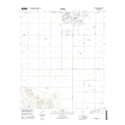
2014 Map of Arizona City
USGS Topo · Published 2014About this map
The master-planned layout of Arizona City stands in sharp contrast to the surrounding agricultural and desert landscape of Pinal County. This modern settlement, organized around a dense network of residential streets like S Country Club Dr and S Rory Calhoun Rd, sits just north of the vast Santa Cruz Flats. To the south, the terrain shifts dramatically as the Sawtooth Mountains rise from the valley floor, their sharp contours defined against the ephemeral drainage of Greene Wash. This survey captures the region's 21st-century character, where irrigation and residential development intersect with traditional land use. Smaller communities such as Chuichu and the outskirts of Eloy appear at the edges of large sectioned tracts, illustrating the sparse but deliberate distribution of human activity across the arid basin.
Find a feature on this map
74 named features on this map. Tap any name to fly to it.
Don’t see what you’re looking for? This feature index may not catch every label — zoom into the map to look around manually.
Map Details
Editions of this 2014 Arizona City Map
This is the sole edition of this map. No revisions or reprints were ever made.
Other maps of this area

1922 · Casa Grande
USGS Topo · 1:62,500

1922 · Signal Peak
USGS Topo · 1:62,500

1924 · Signal Peak
USGS Topo · 1:62,500

1924 · Casa Grande
USGS Topo · 1:62,500

1942 · Silver Reef Mountains
USGS Topo · 1:62,500

1947 · Eloy
USGS Topo · 1:62,500

1948 · Eloy
USGS Topo · 1:62,500

1956 · Tucson
USGS Topo · 1:250,000

1958 · Tucson
USGS Topo · 1:250,000

1959 · Tucson
USGS Topo · 1:250,000