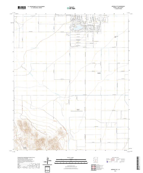
2021 Map of Arizona City
USGS Topo · Published 2021About this map
The Santa Cruz Flats define the central geography of this Pinal County landscape, where the ephemeral Greene Wash cuts across the arid basin floor. This 2021 record captures the residential expansion north of Eloy, characterized by a dense grid of modern street names such as S Rory Calhoun Rd and W Mission Dr. The suburban development contrasts sharply with the open agricultural and desert lands to the south and west, where the Sawtooth Mountains rise abruptly from the valley floor.
Find a feature on this map
72 named features on this map. Tap any name to fly to it.
Don’t see what you’re looking for? This feature index may not catch every label — zoom into the map to look around manually.
Map Details
Editions of this 2021 Arizona City Map
This is the sole edition of this map. No revisions or reprints were ever made.
Other maps of this area

1922 · Casa Grande
USGS Topo · 1:62,500

1922 · Signal Peak
USGS Topo · 1:62,500

1924 · Signal Peak
USGS Topo · 1:62,500

1924 · Casa Grande
USGS Topo · 1:62,500

1942 · Silver Reef Mountains
USGS Topo · 1:62,500

1947 · Eloy
USGS Topo · 1:62,500

1948 · Eloy
USGS Topo · 1:62,500

1956 · Tucson
USGS Topo · 1:250,000

1958 · Tucson
USGS Topo · 1:250,000

1959 · Tucson
USGS Topo · 1:250,000