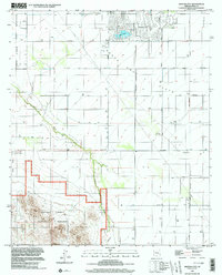
1996 Map of Arizona City
USGS Topo · Published 2003About this map
Arizona City and the surrounding Santa Cruz Flats are defined here by a transition from organized residential planning to the open desert of the Sawtooth Mountains. This late 20th-century landscape features the residential development of Lake Towers and a nearby Golf Course, contrasting with the expansive protected lands of the Ironwood Forest National Monument to the southwest. The presence of numerous wells across the flats illustrates the vital role of groundwater management in this arid environment, while the path of Greene Wash marks the natural drainage through the terrain. To the west, the Tohono O'odham Indian Reservation boundary is clearly delineated, alongside a local Landing Strip and the small outpost of Curry Camp, showing the variety of land uses from desert recreation to tribal sovereignty.
Find a feature on this map
28 named features on this map. Tap any name to fly to it.
Don’t see what you’re looking for? This feature index may not catch every label — zoom into the map to look around manually.
Map Details
Editions of this 1996 Arizona City Map
This is the sole edition of this map. No revisions or reprints were ever made.
Other maps of this area

1922 · Casa Grande
USGS Topo · 1:62,500

1922 · Signal Peak
USGS Topo · 1:62,500

1924 · Signal Peak
USGS Topo · 1:62,500

1924 · Casa Grande
USGS Topo · 1:62,500

1942 · Silver Reef Mountains
USGS Topo · 1:62,500

1947 · Eloy
USGS Topo · 1:62,500

1948 · Eloy
USGS Topo · 1:62,500

1956 · Tucson
USGS Topo · 1:250,000

1958 · Tucson
USGS Topo · 1:250,000

1959 · Tucson
USGS Topo · 1:250,000