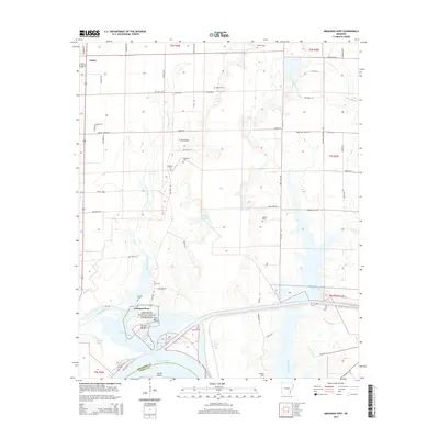
2014 Map of Arkansas Post
USGS Topo · Published 2014About this map
Arkansas Post National Memorial anchors this landscape at the intersection of the Arkansas River and the Arkansas Post Canal. This survey documents a region defined by its complex hydrology and early colonial importance, centered on the settlement of Arkansas Post. The area is characterized by a dense network of water bodies, including Little Post Bayou, Parish Lake, and the winding Menard Bayou, which reflect the dynamic nature of the river delta. North of the river, the city of Gillett sits amidst a grid of rural roads and family-named landmarks. Numerous small burial sites, such as Mt Olive Cem, Champion Cem, and Skull Cem, are scattered across the terrain, offering significant points of interest for genealogists and local historians tracing the heritage of this riverfront community. The map also highlights distinctive landforms like Post Bend and Ecores Rouges, which have historically shaped navigation and settlement patterns along the waterway.
Find a feature on this map
74 named features on this map. Tap any name to fly to it.
Don’t see what you’re looking for? This feature index may not catch every label — zoom into the map to look around manually.
Map Details
Editions of this 2014 Arkansas Post Map
This is the sole edition of this map. No revisions or reprints were ever made.
Other maps of this area

1935 · Red Fork
USGS Topo · 1:62,500

1935 · Gillett
USGS Topo · 1:62,500

1939 · Henrico
USGS Topo · 1:62,500

1939 · Big Island
USGS Topo · 1:62,500

1948 · Helena
USGS Topo · 1:250,000

1950 · Helena
USGS Topo · 1:250,000

1953 · Greenwood
USGS Topo · 1:250,000

1954 · Henrico
USGS Topo · 1:62,500

1955 · Helena
USGS Topo · 1:250,000

1956 · Greenwood
USGS Topo · 1:250,000