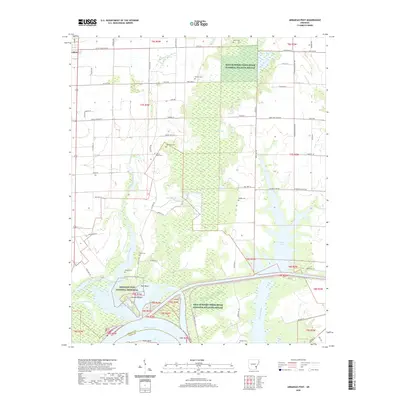
2020 Map of Arkansas Post
USGS Topo · Published 2020About this map
Arkansas Post National Memorial sits at a strategic bend in the Arkansas River, marking one of the most significant colonial-era sites in the Mississippi Valley. The landscape is defined by the complex water systems of the Arkansas Delta, where the Arkansas Post Canal links the river to Merrisach Lake and the surrounding wetland system. This 2020 survey reveals the modern conservation footprint of the Dale Bumpers White River National Wildlife Refuge, which preserves the bottomland hardwood forests and swamps like Dismal Swamp and Parish Lake.
Find a feature on this map
70 named features on this map. Tap any name to fly to it.
Don’t see what you’re looking for? This feature index may not catch every label — zoom into the map to look around manually.
Map Details
Editions of this 2020 Arkansas Post Map
This is the sole edition of this map. No revisions or reprints were ever made.
Other maps of this area

1935 · Red Fork
USGS Topo · 1:62,500

1935 · Gillett
USGS Topo · 1:62,500

1939 · Henrico
USGS Topo · 1:62,500

1939 · Big Island
USGS Topo · 1:62,500

1948 · Helena
USGS Topo · 1:250,000

1950 · Helena
USGS Topo · 1:250,000

1953 · Greenwood
USGS Topo · 1:250,000

1954 · Henrico
USGS Topo · 1:62,500

1955 · Helena
USGS Topo · 1:250,000

1956 · Greenwood
USGS Topo · 1:250,000