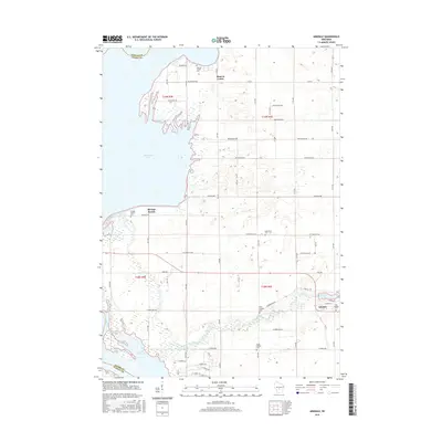
2015 Map of Arkdale
USGS Topo · Published 2015About this map
The settlement of Arkdale and the surrounding rural landscapes of Adams County are defined by the convergence of agricultural land and major hydraulic features. To the west, the shoreline of Petenwell Lake and the northern reaches of Castle Rock Lake along the Wisconsin River dominate the geography, while the meandering course of Big Roche a Cri Creek flows through the southern half of the quadrangle. The map reveals a high density of small cemeteries scattered across the township, including Monroe Center Cem, Edwardson Cem, and three distinct burial grounds associated with Arkdale, suggesting a well-established and long-standing community footprint.
Find a feature on this map
58 named features on this map. Tap any name to fly to it.
Don’t see what you’re looking for? This feature index may not catch every label — zoom into the map to look around manually.
Map Details
Editions of this 2015 Arkdale Map
This is the sole edition of this map. No revisions or reprints were ever made.
Other maps of this area

1921 · Mauston
USGS Topo · 1:62,500

1953 · Eau Claire
USGS Topo · 1:250,000

1955 · Green Bay
USGS Topo · 1:250,000

1957 · Madison
USGS Topo · 1:250,000

1958 · Eau Claire
USGS Topo · 1:250,000

1958 · Arkdale
USGS Topo · 1:48,000

1958 · Necedah
USGS Topo · 1:48,000

1958 · La Crosse
USGS Topo · 1:250,000

1960 · Madison
USGS Topo · 1:250,000

1961 · La Crosse
USGS Topo · 1:250,000