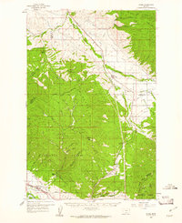
1959 Map of Arlee
USGS Topo · Published 1961About this map
The Jocko River valley serves as a central corridor for the Northern Pacific railroad and transportation routes through the Flathead Indian Reservation in the late 1950s. The settlement of Arlee stands as a primary hub, while smaller communities like Schley and Agency line the eastern rail corridor. Toward the south, the landscape transitions into the heavily forested reaches of the Lolo National Forest, where the terrain rises toward Charity Peak and Saddle Mountain. Local history is anchored by specific landmarks such as the Mission Ch near the Lake County border and the Frenchtown Cem in the southwest corner near the C M St P & P line. Notable family operations, including the Nielson Ranch and Baldwin Ranch, are scattered throughout the valley floors, illustrating the ranching and agricultural patterns established along Valley Creek and Finley Creek before modern development altered the rural character of the region.
Find a feature on this map
49 named features on this map. Tap any name to fly to it.
Don’t see what you’re looking for? This feature index may not catch every label — zoom into the map to look around manually.
Map Details
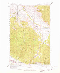
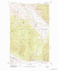
Editions of this 1959 Arlee Map
3 editions found
Other maps of this area

1903 · Bonner
USGS Topo · 1:125,000

1912 · Missoula
USGS Topo · 1:125,000

1921 · Elbow Lake
USGS Topo · 1:125,000

1947 · Butte
USGS Topo · 1:250,000

1955 · Choteau
USGS Topo · 1:250,000

1956 · Wallace
USGS Topo · 1:250,000

1956 · Hamilton
USGS Topo · 1:250,000

1957 · Choteau
USGS Topo · 1:250,000

1958 · Butte
USGS Topo · 1:250,000

1958 · Choteau
USGS Topo · 1:250,000