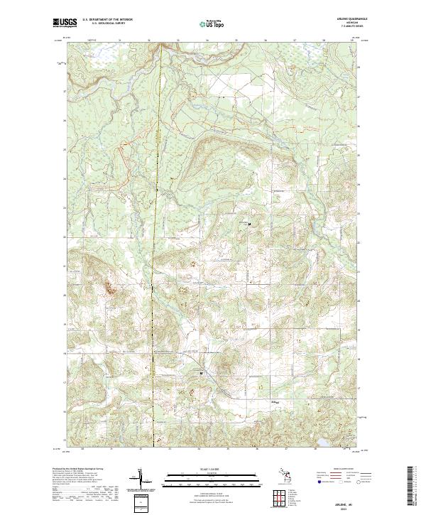
2023 Map of Arlene
USGS Topo · Published 2023About this map
Arlene sits at the heart of this North Central Michigan landscape, where the rural grid meets the winding courses of the Manistee River and its numerous tributaries. The terrain is defined by a complex network of waterways, including Hopkins Creek, Golden Creek, and Morrissey Creek, which carve through the glacial topography. Cultural markers important for genealogical research are preserved here, notably Bloomfield Cem and Caldwell Cem, which serve as quiet anchors for the surrounding farmsteads. The presence of the Shore To Shore Trl and North Missaukee Trl highlights the area's transition into a recreational landscape while maintaining its historic township structure. Local landmarks like Boiling Springs and Ham Creek further emphasize the water-rich nature of this Missaukee County region, while the boundary with Wexford County marks the western edge of the survey.
Find a feature on this map
58 named features on this map. Tap any name to fly to it.
Don’t see what you’re looking for? This feature index may not catch every label — zoom into the map to look around manually.
Map Details
Editions of this 2023 Arlene Map
This is the sole edition of this map. No revisions or reprints were ever made.
Other maps of this area

1954 · Traverse City
USGS Topo · 1:250,000

1956 · Kalkaska
USGS Topo · 1:62,500

1956 · Fife Lake
USGS Topo · 1:62,500

1956 · Cadillac North
USGS Topo · 1:62,500

1956 · Lake City
USGS Topo · 1:62,500

1958 · Traverse City
USGS Topo · 1:250,000

1983 · Cadillac
USGS Topo · 1:100,000

1983 · Lake City
USGS Topo · 1:25,000

1983 · Manton
USGS Topo · 1:25,000

1983 · Cadillac North
USGS Topo · 1:24,000