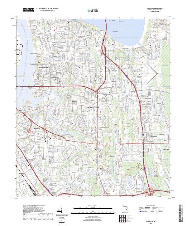
2024 Map of Arlington
USGS Topo · Published 2024About this map
Pottsburg Creek and the Arlington River wind through the eastern suburbs of Jacksonville, defining a landscape of tidal inlets and established residential communities. This 2024 survey captures the densely networked neighborhoods of Arlington, Sandalwood, and Southside Estates, where modern thoroughfares like Atlantic Blvd and Beach Blvd intersect historical footprints. Genetic and local researchers will find numerous small burial grounds such as Parsons Cem, Gilmore Cem, and the Sammis Cem near Floral Bluff. The map also illustrates significant educational and infrastructure hubs, including the University of North Florida campus and the Jacksonville Executive Airport at Craig. Prominent natural features like Mitchell Bluff and the wetlands of Sawmill Slough contrast with the industrial and transit-focused development near Bowden and South Metro, showing how the city’s expansion has integrated with the complex hydrography of the St. Johns River basin.
Find a feature on this map
69 named features on this map. Tap any name to fly to it.
Don’t see what you’re looking for? This feature index may not catch every label — zoom into the map to look around manually.
Map Details
Editions of this 2024 Arlington Map
This is the sole edition of this map. No revisions or reprints were ever made.
Other maps of this area

1917 · Orange Park
USGS Topo · 1:62,500

1918 · Jacksonville
USGS Topo · 1:62,500

1918 · Orange Park
USGS Topo · 1:62,500

1918 · Palm Valley
USGS Topo · 1:62,500

1918 · Mayport
USGS Topo · 1:62,500

1948 · Jacksonville
USGS Topo · 1:250,000

1948 · Jacksonville Beach
USGS Topo · 1:24,000

1948 · Eastport
USGS Topo · 1:24,000

1949 · Jacksonville Beach
USGS Topo · 1:24,000

1950 · Arlington
USGS Topo · 1:24,000
Featured Places
- Jacksonville, FL
- Holiday Hill, Jacksonville
- Greenfield Manor, Jacksonville
- Newcastle, Jacksonville
- Beechwood, Jacksonville