
1950 Map of Arlington
USGS Topo · Published 1950About this map
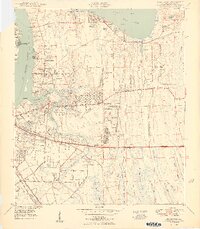
St Johns River and the winding Arlington River define the western reaches of this 1950 survey, showcasing a landscape in transition from rural riverfront to post-war suburban development. Inland, the growth of residential clusters like Oakwood Villa and Southside Estates contrasts with the dense networks of Big Island Swamp and Cedar Swamp to the east. The map records several legacy landmarks, including the prehistoric Indian Mound near Newcastle Creek and the Flagler Lookout Tower along Beach Boulevard, which was still under construction at the time of the survey.
Find a feature on this map
73 named features on this map. Tap any name to fly to it.
Don’t see what you’re looking for? This feature index may not catch every label — zoom into the map to look around manually.
Map Details
Editions of this 1950 Arlington Map
2 editions found
Other maps of this area

1917 · Orange Park
USGS Topo · 1:62,500

1918 · Jacksonville
USGS Topo · 1:62,500

1918 · Orange Park
USGS Topo · 1:62,500

1918 · Palm Valley
USGS Topo · 1:62,500

1918 · Mayport
USGS Topo · 1:62,500

1948 · Jacksonville
USGS Topo · 1:250,000

1948 · Jacksonville Beach
USGS Topo · 1:24,000

1948 · Eastport
USGS Topo · 1:24,000

1949 · Jacksonville Beach
USGS Topo · 1:24,000
1950 · Mayport
USGS Topo · 1:24,000
Featured Places
- Jacksonville, FL
- Holiday Hill, Jacksonville
- Newcastle, Jacksonville
- Hogan, Jacksonville
- Bridgewater, Jacksonville