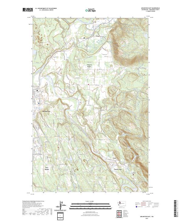
2023 Map of Arlington East
USGS Topo · Published 2023About this map
The North Fork Stillaguamish River and South Fork Stillaguamish River converge near the western boundary of this territory, framing the development of Arlington. Modern residential growth extends eastward into Arlington Heights and south toward Sisco Heights, while the eastern portion of the map transitions into the rising elevations of Ebey Hill and Jordan Ridge. Local history is anchored by several burial sites, including Trafton Cem near the northern settlement of Trafton and the Pioneer Cem closer to the town center. The landscape is defined by its drainages, where Jim Creek and Jordan Creek flow through the valleys toward the Stillaguamish. Small water bodies like Mud Lake and King Lake sit tucked within the ridges, illustrating the glaciated terrain typical of this part of Snohomish County.
Find a feature on this map
81 named features on this map. Tap any name to fly to it.
Don’t see what you’re looking for? This feature index may not catch every label — zoom into the map to look around manually.
Map Details
Editions of this 2023 Arlington East Map
This is the sole edition of this map. No revisions or reprints were ever made.
Other maps of this area

1899 · Stillaguamish
USGS Topo · 1:125,000

1901 · Stilaguamish
USGS Topo · 1:125,000

1911 · Mount Vernon
USGS Topo · 1:125,000

1941 · Marysville
USGS Topo · 1:62,500

1943 · Marysville
USGS Topo · 1:62,500

1944 · Clear Lake
USGS Topo · 1:62,500

1955 · Concrete
USGS Topo · 1:250,000

1956 · Arlington West
USGS Topo · 1:24,000

1956 · Arlington East
USGS Topo · 1:24,000
1956 · Lake Stevens
USGS Topo · 1:24,000