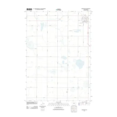
2012 Map of Arlington
USGS Topo · Published 2012About this map
Arlington stands as the primary hub in this portion of South Dakota, where the grid of city streets like N Main St and S Willow St meets the expansive section-line road network of the surrounding prairie. The landscape is defined by its glacial hydrology, featuring significant water bodies such as Lake Whitewood to the west and the marshy expanse of Tenneboe Slough. For those researching local heritage, the map identifies several burial grounds situated throughout the countryside, including Nordland Cem, Bangor Cem, and Pleasant View Cem. The town itself is well-developed with a central Po and the Arlington Cem located on its southeastern outskirts. This topographic study illustrates a rural economy organized around these water features and the reliable north-south corridors of 450th Ave and 452nd Ave, which tie the dispersed farmsteads to the commercial center of Arlington.
Find a feature on this map
37 named features on this map. Tap any name to fly to it.
Don’t see what you’re looking for? This feature index may not catch every label — zoom into the map to look around manually.
Map Details
Editions of this 2012 Arlington Map
This is the sole edition of this map. No revisions or reprints were ever made.
Other maps of this area

1953 · Watertown
USGS Topo · 1:250,000

1958 · Watertown
USGS Topo · 1:250,000

1968 · Lake Sinai
USGS Topo · 1:24,000

1968 · Lake Preston East
USGS Topo · 1:24,000

1968 · Lake Preston NE
USGS Topo · 1:24,000

1968 · Arlington
USGS Topo · 1:24,000

1968 · Arlington NE
USGS Topo · 1:24,000

1968 · Sinai
USGS Topo · 1:24,000

1968 · Oldham
USGS Topo · 1:24,000

1968 · Badger
USGS Topo · 1:24,000