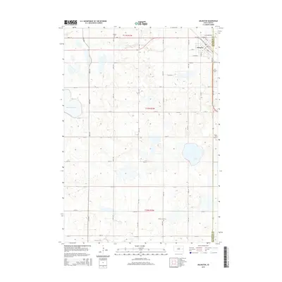
2015 Map of Arlington
USGS Topo · Published 2015About this map
Arlington sits at the intersection of early settlement patterns in Eastern South Dakota, where the boundary between Kingsbury and Brookings Counties defines the landscape. The town plan is preserved in detail, featuring a grid of residential and commercial streets including S Main St, W Cottonwood St, and S Spruce St. Outside the town center, the land is marked by a series of burial grounds that anchor the local genealogy, such as Nordland Cem to the northwest, Arlington Cem to the east, and Pleasant View Cem to the south. The natural topography is characterized by the prairie pothole region's distinctive hydrology, with the large expanse of Lake Whitewood dominating the western edge and Twin Lakes situated to the southeast, reflecting the glacial heritage of the Dakota plains.
Find a feature on this map
37 named features on this map. Tap any name to fly to it.
Don’t see what you’re looking for? This feature index may not catch every label — zoom into the map to look around manually.
Map Details
Editions of this 2015 Arlington Map
This is the sole edition of this map. No revisions or reprints were ever made.
Other maps of this area

1953 · Watertown
USGS Topo · 1:250,000

1958 · Watertown
USGS Topo · 1:250,000

1968 · Lake Sinai
USGS Topo · 1:24,000

1968 · Lake Preston East
USGS Topo · 1:24,000

1968 · Lake Preston NE
USGS Topo · 1:24,000

1968 · Arlington
USGS Topo · 1:24,000

1968 · Arlington NE
USGS Topo · 1:24,000

1968 · Sinai
USGS Topo · 1:24,000

1968 · Oldham
USGS Topo · 1:24,000

1968 · Badger
USGS Topo · 1:24,000