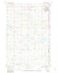
1968 Map of Arlington
USGS Topo · Published 1982About this map
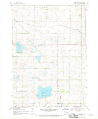
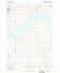
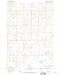
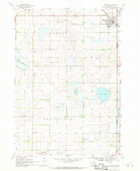
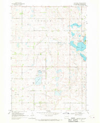
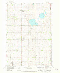
Arlington serves as the primary hub of this eastern South Dakota landscape, situated at the junction of the Burlington Northern railroad and regional highways. The map illustrates a prairie environment defined by significant water bodies and marshlands, including the expansive Lake Whitewood and the nearby Tenneboe Slough. These natural features are interspersed with rural townships such as Denver and Spring Lake, where settlement patterns follow a strict section-line grid. Local heritage is rooted in small community centers like Hetland and several country churches and cemeteries. Genealogists may find interest in the locations of Nordland Cem, Pleasant View Cem, and Lake Whitewood Ch. The eastern edge of the quadrangle marks the boundary between Kingsbury and Brookings counties, while the southern portion reveals the National Wildlife Management Area near the shores of Lake Sinai.
Find a feature on this map
19 named features on this map. Tap any name to fly to it.
Don’t see what you’re looking for? This feature index may not catch every label — zoom into the map to look around manually.
Map Details
Editions of this 1968 Arlington Map
2 editions found
Other maps of this area

1953 · Watertown
USGS Topo · 1:250,000

1958 · Watertown
USGS Topo · 1:250,000
1968 · Lake Sinai
USGS Topo · 1:24,000
1968 · Lake Preston East
USGS Topo · 1:24,000
1968 · Lake Preston NE
USGS Topo · 1:24,000
1968 · Arlington
USGS Topo · 1:24,000
1968 · Arlington NE
USGS Topo · 1:24,000
1968 · Sinai
USGS Topo · 1:24,000
1968 · Oldham
USGS Topo · 1:24,000
1968 · Badger
USGS Topo · 1:24,000