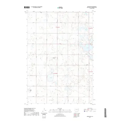
2017 Map of Arlington NE
USGS Topo · Published 2017About this map
Coteau des Prairies, the vast upland plateau, defines the rolling geography of this Brookings County landscape. The area is characterized by numerous glacial depressions, including Lake Mitchell, Lake Tetonkaha, Moe Slough, and Mortimer Slough, which dominate the eastern and central sections of the quadrangle. This 2017 survey shows a well-defined section line road grid, with routes like 455th Ave and 200th St providing access to the agricultural interior. For those researching local history or genealogy, several established landmarks are visible, including Bethel Cem, Trasta Cem, and Oakwood Zion Cem, which sit alongside these rural corridors. The Arlington Municipal Airport in the southwest provides a modern transportation anchor for the surrounding township.
Find a feature on this map
29 named features on this map. Tap any name to fly to it.
Don’t see what you’re looking for? This feature index may not catch every label — zoom into the map to look around manually.
Map Details
Editions of this 2017 Arlington NE Map
This is the sole edition of this map. No revisions or reprints were ever made.
Other maps of this area

1953 · Watertown
USGS Topo · 1:250,000

1958 · Watertown
USGS Topo · 1:250,000

1968 · Lake Sinai
USGS Topo · 1:24,000

1968 · Bruce
USGS Topo · 1:24,000

1968 · Arlington
USGS Topo · 1:24,000

1968 · Volga
USGS Topo · 1:24,000

1968 · Arlington NE
USGS Topo · 1:24,000

1968 · Badger
USGS Topo · 1:24,000

1969 · Lake Norden
USGS Topo · 1:24,000

1969 · Lake Poinsett
USGS Topo · 1:24,000