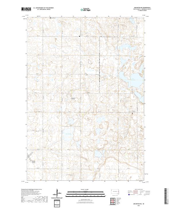
2021 Map of Arlington NE
USGS Topo · Published 2021About this map
Coteau des Prairies, a vast upland plateau, defines the topography of this Brookings County landscape. The region is marked by glacial depressions and water features typical of the prairie pothole region, including Lake Mitchell, Moe Slough, and the western reaches of Lake Tetonkaha. The agricultural character of the area is underscored by a rigid grid of rural routes such as 457th Ave and 203rd St, which connect isolated homesteads and local landmarks. For those tracing family histories in the Arlington area, the map identifies three distinct burial grounds: Bethel Cem, Trasta Cem, and Oakwood Zion Cem. Near the southwestern corner, the Arlington Municipal Airport serves as a modern waypoint in this otherwise traditional farming landscape, reflecting the long-term patterns of settlement and land use across the South Dakota plains.
Find a feature on this map
27 named features on this map. Tap any name to fly to it.
Don’t see what you’re looking for? This feature index may not catch every label — zoom into the map to look around manually.
Map Details
Editions of this 2021 Arlington NE Map
This is the sole edition of this map. No revisions or reprints were ever made.
Other maps of this area

1953 · Watertown
USGS Topo · 1:250,000

1958 · Watertown
USGS Topo · 1:250,000

1968 · Lake Sinai
USGS Topo · 1:24,000

1968 · Bruce
USGS Topo · 1:24,000

1968 · Arlington
USGS Topo · 1:24,000

1968 · Volga
USGS Topo · 1:24,000

1968 · Arlington NE
USGS Topo · 1:24,000

1968 · Badger
USGS Topo · 1:24,000

1969 · Lake Norden
USGS Topo · 1:24,000

1969 · Lake Poinsett
USGS Topo · 1:24,000