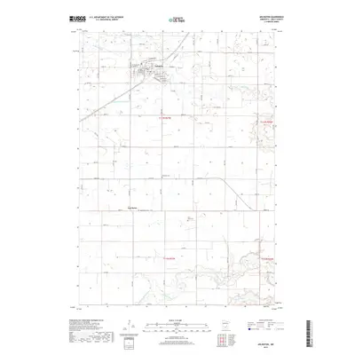
2019 Map of Arlington
USGS Topo · Published 2019About this map
Arlington serves as the primary hub in this portion of Sibley County, where the street grid transitions into the broad agricultural reaches of southern Minnesota. The landscape is defined by the hydrologic network of High Island Cr and its managed watercourses, such as High Island Ditch Number Five, which illustrate the region's long history of land drainage for cultivation. To the south, the terrain becomes more complex as the various branches of the Rush River carve through the prairie, including the Middle Br Rush River and N Br Rush River. For those researching local history, the map preserves the location of several rural landmarks, most notably the settlement of New Rome and a series of historic burial grounds like Ebenezer Cem and Weckworth Cem, which mark the early footprints of the community's pioneer families.
Find a feature on this map
63 named features on this map. Tap any name to fly to it.
Don’t see what you’re looking for? This feature index may not catch every label — zoom into the map to look around manually.
Map Details
Editions of this 2019 Arlington Map
This is the sole edition of this map. No revisions or reprints were ever made.
Other maps of this area

1953 · Saint Paul
USGS Topo · 1:250,000

1953 · New Ulm
USGS Topo · 1:250,000

1957 · New Ulm
USGS Topo · 1:250,000

1957 · Belle Plaine
USGS Topo · 1:62,500

1958 · New Ulm
USGS Topo · 1:250,000

1958 · Gaylord
USGS Topo · 1:62,500

1959 · Saint Paul
USGS Topo · 1:250,000

1965 · Norseland
USGS Topo · 1:24,000

1965 · New Sweden
USGS Topo · 1:24,000

1965 · Le Sueur
USGS Topo · 1:24,000