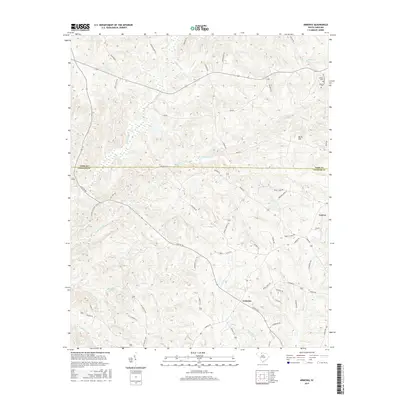
2017 Map of Armenia
USGS Topo · Published 2017About this map
Lowrys and the rural community of Armenia anchor this section of the South Carolina Piedmont, where the landscape is defined by the intricate drainage networks of Susybole Creek and Mill Creek. The terrain is characterized by numerous small branches and creeks that have shaped the local settlement patterns and road systems, such as Center Rd and Armenia Rd. In the northeastern corner, Olivet Cem and Bethany Cem provide important geographic touchpoints for genealogical research and local heritage, situated near the headwaters of Bryson Cr.
Find a feature on this map
62 named features on this map. Tap any name to fly to it.
Don’t see what you’re looking for? This feature index may not catch every label — zoom into the map to look around manually.
Map Details
Editions of this 2017 Armenia Map
This is the sole edition of this map. No revisions or reprints were ever made.
Other maps of this area

1907 · Sharon
USGS Topo · 1:62,500

1941 · Spartanburg
USGS Topo · 1:250,000

1949 · Rock Hill
USGS Topo · 1:62,500

1953 · Spartanburg
USGS Topo · 1:250,000

1960 · Spartanburg
USGS Topo · 1:250,000

1963 · Spartanburg
USGS Topo · 1:250,000

1964 · Spartanburg
USGS Topo · 1:250,000

1969 · Baton Rouge
USGS Topo · 1:24,000
1969 · Chester
USGS Topo · 1:24,000
1969 · Leeds
USGS Topo · 1:24,000