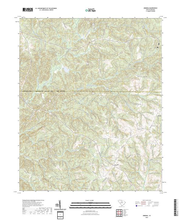
2024 Map of Armenia
USGS Topo · Published 2024About this map
The unincorporated community of Armenia sits at the heart of this South Carolina landscape, where the northern border of Chester County meets the southern edge of York County. The terrain is defined by an intricate network of waterways, including the drainage of Turkey Creek, Susybole Creek, and Little Susybole Creek as they flow toward the Sandy River. For genealogists and local historians, the presence of Olivet Cem and Bethany Cem near the northeastern corner provides vital anchors for family research in this rural region.
Find a feature on this map
62 named features on this map. Tap any name to fly to it.
Don’t see what you’re looking for? This feature index may not catch every label — zoom into the map to look around manually.
Map Details
Editions of this 2024 Armenia Map
This is the sole edition of this map. No revisions or reprints were ever made.
Other maps of this area

1907 · Sharon
USGS Topo · 1:62,500

1941 · Spartanburg
USGS Topo · 1:250,000

1949 · Rock Hill
USGS Topo · 1:62,500

1953 · Spartanburg
USGS Topo · 1:250,000

1960 · Spartanburg
USGS Topo · 1:250,000

1963 · Spartanburg
USGS Topo · 1:250,000

1964 · Spartanburg
USGS Topo · 1:250,000

1969 · Baton Rouge
USGS Topo · 1:24,000
1969 · Chester
USGS Topo · 1:24,000
1969 · Leeds
USGS Topo · 1:24,000