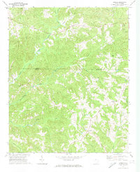
1972 Map of Armenia
USGS Topo · Published 1974About this map
Armenia and Lowrys serve as the primary focal points of this rural landscape spanning the border of Chester and York Counties. The area is defined by a dense network of country churches and family burial grounds, including Old Providence Ch Cem and Mt Pleasant Ch Cem, which anchor the local community history. Educational infrastructure is represented by the North Chester Sch, situated amidst a terrain heavily dissected by watercourses like Turkey Creek and Swayhole Creek. The presence of a Sandpit and Quarry suggests localized resource extraction within the predominantly agricultural setting. The map reveals a transition from these higher elevations, such as Bulls Hill, down toward the various branches and forks that feed into the Sandy River, providing a clear view of the settlement patterns and road networks as they existed in the early 1970s.
Find a feature on this map
31 named features on this map. Tap any name to fly to it.
Don’t see what you’re looking for? This feature index may not catch every label — zoom into the map to look around manually.
Map Details
Editions of this 1972 Armenia Map
This is the sole edition of this map. No revisions or reprints were ever made.
Other maps of this area

1907 · Sharon
USGS Topo · 1:62,500

1941 · Spartanburg
USGS Topo · 1:250,000

1949 · Rock Hill
USGS Topo · 1:62,500

1953 · Spartanburg
USGS Topo · 1:250,000

1960 · Spartanburg
USGS Topo · 1:250,000

1963 · Spartanburg
USGS Topo · 1:250,000

1964 · Spartanburg
USGS Topo · 1:250,000

1969 · Baton Rouge
USGS Topo · 1:24,000
1969 · Chester
USGS Topo · 1:24,000
1969 · Leeds
USGS Topo · 1:24,000