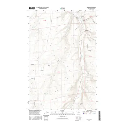
2017 Map of Armington
USGS Topo · Published 2017About this map
Belt Creek winds through this central Montana landscape, carving a deep path that defines the local geography. The settlement of Armington and the nearby Armington Junction serve as focal points for the area's transportation network, where several rural routes converge near the valley floor. High above the water, landforms like Swede Bench and Rainbow Ridge suggest a topographically diverse environment where agriculture and ranching have long adapted to the shifting elevations. Family history and local heritage are anchored by the presence of Pleasant View Cem in the north and Goodman Cem to the south. The map documents an intricate system of drainages, including French Coulee and Armington Coulee, which channel runoff from the surrounding highlands into the main creek bed, illustrating the natural erosion patterns of the Cascade County terrain.
Find a feature on this map
28 named features on this map. Tap any name to fly to it.
Don’t see what you’re looking for? This feature index may not catch every label — zoom into the map to look around manually.
Map Details
Editions of this 2017 Armington Map
This is the sole edition of this map. No revisions or reprints were ever made.
Other maps of this area

1886 · Great Falls
USGS Topo · 1:250,000

1890 · Fort Benton
USGS Topo · 1:250,000

1892 · Fort Benton
USGS Topo · 1:250,000

1897 · Fort Benton
USGS Topo · 1:250,000

1954 · Great Falls
USGS Topo · 1:250,000

1955 · Stockett
USGS Topo · 1:62,500

1956 · Belt
USGS Topo · 1:62,500

1957 · Great Falls
USGS Topo · 1:250,000
1965 · Fife
USGS Topo · 1:24,000

1965 · Mahoney Hill
USGS Topo · 1:24,000