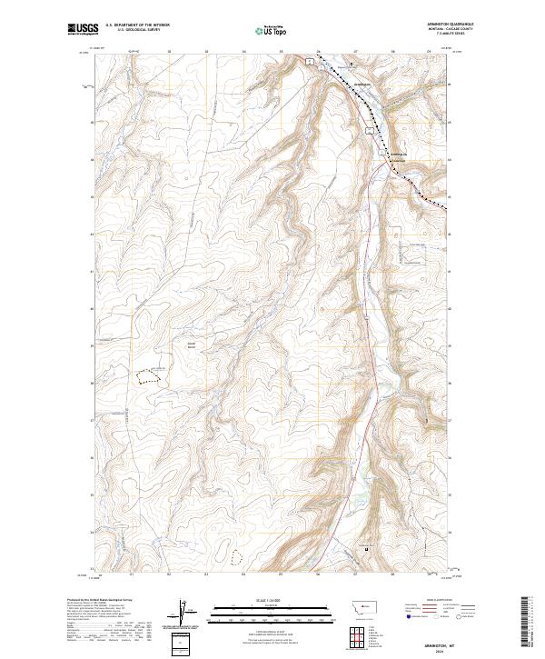
2024 Map of Armington
USGS Topo · Published 2024About this map
Belt Creek winds through this central Montana landscape, serving as a primary drainage for the area north of the Little Belt Mountains. The settlement of Armington and the nearby Armington Junction mark a critical crossroads where several coulees and creek valleys converge. The terrain is characterized by elevated features such as Swede Bench and Rainbow Ridge, which divide the various watersheds of Neil Creek and French Coulee.
Find a feature on this map
30 named features on this map. Tap any name to fly to it.
Don’t see what you’re looking for? This feature index may not catch every label — zoom into the map to look around manually.
Map Details
Editions of this 2024 Armington Map
This is the sole edition of this map. No revisions or reprints were ever made.
Other maps of this area

1886 · Great Falls
USGS Topo · 1:250,000

1890 · Fort Benton
USGS Topo · 1:250,000

1892 · Fort Benton
USGS Topo · 1:250,000

1897 · Fort Benton
USGS Topo · 1:250,000

1954 · Great Falls
USGS Topo · 1:250,000

1955 · Stockett
USGS Topo · 1:62,500

1956 · Belt
USGS Topo · 1:62,500

1957 · Great Falls
USGS Topo · 1:250,000
1965 · Fife
USGS Topo · 1:24,000

1965 · Mahoney Hill
USGS Topo · 1:24,000