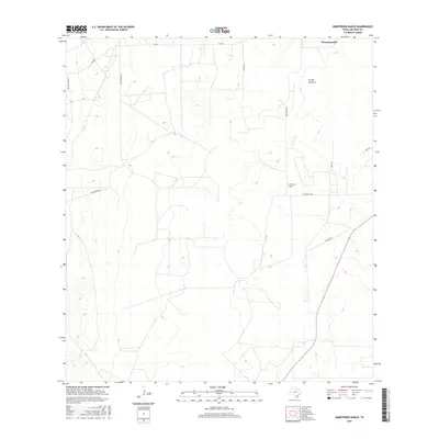
2016 Map of Armstrong Ranch
USGS Topo · Published 2016About this map
Armstrong Ranch serves as the focal point for this rural South Texas landscape in Jim Hogg County. The area is characterized by vast open ranchlands and a sparse network of private roads and lanes that define property boundaries. Local family and ranch names are preserved in the road network, including Polo Creamer Ln, Aa Martinez Rd, and Canales Ln. The primary drainage feature is the Arroyo del Gato, which meanders through the eastern portion of the quadrangle. At the northern edge, the small community of Thompsonville provides a glimpse into the settlement patterns of this cattle-country region. The road system, including La Chancaca Rd and S Old Hwy 16, reflects the long-distance connectivity required in this part of the state where large holdings remain the norm.
Find a feature on this map
12 named features on this map. Tap any name to fly to it.
Don’t see what you’re looking for? This feature index may not catch every label — zoom into the map to look around manually.
Map Details
Editions of this 2016 Armstrong Ranch Map
This is the sole edition of this map. No revisions or reprints were ever made.
Other maps of this area

1939 · Bruni
USGS Topo · 1:62,500

1939 · Randado
USGS Topo · 1:62,500

1940 · Randado
USGS Topo · 1:62,500

1956 · Laredo
USGS Topo · 1:250,000

1967 · Hebbronville
USGS Topo · 1:24,000

1972 · Armstrong Ranch
USGS Topo · 1:24,000
1972 · San Pablo Ranch
USGS Topo · 1:24,000

1972 · Albercas Ranch
USGS Topo · 1:24,000

1972 · Bruni SE
USGS Topo · 1:24,000
1972 · Alta Vista Ranch SW
USGS Topo · 1:24,000