
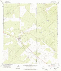
1967 Map of Hebbronville
USGS Topo · Published 1971About this map
Hebbronville serves as the focal point of this late 1960s South Texas landscape, where the Texas Mexican railway cuts a diagonal path through Jim Hogg and Duval counties. The town's civic heart is anchored by the Courthouse and a prominent High School, while the surrounding brushland is defined by a network of ranching infrastructure. Numerous named water sources and landmarks, such as Yeguas Windmill and Las Flores Windmill No 1, point to the importance of groundwater in this semi-arid region.
Find a feature on this map
34 named features on this map. Tap any name to fly to it.
Don’t see what you’re looking for? This feature index may not catch every label — zoom into the map to look around manually.
Map Details
Editions of this 1967 Hebbronville Map
This is the sole edition of this map. No revisions or reprints were ever made.
Other maps of this area

1939 · Bruni
USGS Topo · 1:62,500

1939 · Randado
USGS Topo · 1:62,500

1940 · Randado
USGS Topo · 1:62,500

1956 · Laredo
USGS Topo · 1:250,000

1967 · Hebbronville SE
USGS Topo · 1:24,000

1967 · Realitos
USGS Topo · 1:24,000

1967 · Hebbronville NW
USGS Topo · 1:24,000

1972 · Armstrong Ranch
USGS Topo · 1:24,000

1972 · Bruni SE
USGS Topo · 1:24,000
1972 · Bruni
USGS Topo · 1:24,000
Featured Places
- Hebbronville, TX
- Las Lomitas A Colonia, TX
- South Fork Colonia, TX
- Las Lomitas B Colonia, TX
- Las Lomitas C Colonia, TX