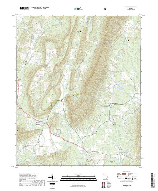
2024 Map of Armuchee
USGS Topo · Published 2024About this map
Dirttown Valley and Haywood Valley form the primary corridors of settlement and transit in this portion of Northwest Georgia. The community of Armuchee sits near the confluence of several mountain-fed waterways, including Little Armuchee Creek and Lavender Creek. This modern survey highlights a landscape where topography strictly dictates human geography, with roads and homesteads clustered in the fertile basins between Little Sand Mtn and the steep slopes of Johns Mtn. A significant portion of the eastern terrain falls within the Chattahoochee National Forest, preserving the wooded character of the ridges. Local history is anchored by numerous rural sites, from the Crystal Springs Mill Pond to the Old Armuchee Cem. The map provides clear detail for tracing early valley roads like Old Summerville Rd and identifying long-standing congregational centers like the Floyd Springs Baptist Church Cem.
Find a feature on this map
73 named features on this map. Tap any name to fly to it.
Don’t see what you’re looking for? This feature index may not catch every label — zoom into the map to look around manually.
Map Details
Editions of this 2024 Armuchee Map
This is the sole edition of this map. No revisions or reprints were ever made.
Other maps of this area

1886 · Ringgold
USGS Topo · 1:125,000

1886 · Rome
USGS Topo · 1:125,000

1892 · Ringgold
USGS Topo · 1:125,000

1898 · Rome
USGS Topo · 1:125,000

1899 · Rome
USGS Topo · 1:125,000

1904 · Rome
USGS Topo · 1:125,000

1955 · Rome
USGS Topo · 1:250,000

1958 · Rome
USGS Topo · 1:250,000

1961 · Rome
USGS Topo · 1:250,000

1963 · Rome
USGS Topo · 1:250,000