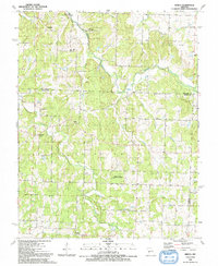
1991 Map of Arnica
USGS Topo · Published 1991About this map
Arnica sits at the southern edge of this Cedar County landscape, where the South Fork Turkey Creek meets Silver Creek. The area is defined by a network of drainage basins including Turkey Creek, Brush Creek, and Purcell Branch, which weave through the townships of Washington and Jefferson. Small community hubs are marked by rural institutions like Fairview Missionary Ch and Hickory Grove Ch, alongside family-named landmarks such as Sneak Cem and Simrell Cem.
Find a feature on this map
28 named features on this map. Tap any name to fly to it.
Don’t see what you’re looking for? This feature index may not catch every label — zoom into the map to look around manually.
Map Details
Editions of this 1991 Arnica Map
This is the sole edition of this map. No revisions or reprints were ever made.
Other maps of this area

1886 · Stockton
USGS Topo · 1:125,000

1938 · Roscoe
USGS Topo · 1:24,000

1938 · Vista
USGS Topo · 1:24,000

1939 · Caplinger Mills
USGS Topo · 1:24,000

1939 · Arnica
USGS Topo · 1:24,000

1940 · Roscoe
USGS Topo · 1:24,000

1940 · Vista
USGS Topo · 1:24,000

1940 · Weaubleau
USGS Topo · 1:24,000

1941 · Caplinger Mills
USGS Topo · 1:24,000

1941 · Arnica
USGS Topo · 1:24,000