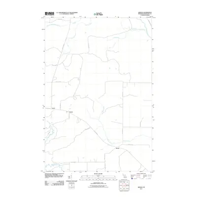
2011 Map of Arnold
USGS Topo · Published 2011About this map
Arnold and the small settlements of Mashek and Watson anchor this corner of Marquette County, where a sparse network of county roads intersects a landscape dominated by river systems. The northern reaches are defined by the winding course of the Little West Branch Escanaba River and its tributaries, including Lone Pine Creek and Lindsey Creek. To the south, the terrain drains toward the Ford River and Hunters Brook, creating a distinct watershed divide between these major Upper Peninsula river basins.
Find a feature on this map
26 named features on this map. Tap any name to fly to it.
Don’t see what you’re looking for? This feature index may not catch every label — zoom into the map to look around manually.
Map Details
Editions of this 2011 Arnold Map
This is the sole edition of this map. No revisions or reprints were ever made.
Other maps of this area

1932 · Helena NW
USGS Topo · 1:31,680

1932 · Helena NE
USGS Topo · 1:31,680

1932 · Whitney NE
USGS Topo · 1:31,680

1932 · Helena SW
USGS Topo · 1:31,680

1932 · Helena
USGS Topo · 1:31,680

1951 · Helena SW
USGS Topo · 1:31,680

1951 · Helena
USGS Topo · 1:31,680

1951 · Helena NE
USGS Topo · 1:31,680

1951 · Helena NW
USGS Topo · 1:31,680

1954 · Escanaba
USGS Topo · 1:250,000