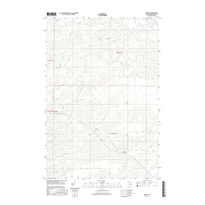
2017 Map of Arnold
USGS Topo · Published 2017About this map
Arnold and Watson anchor this portion of Wells Township, where the headwaters of several significant Michigan waterways converge. The landscape is defined by the winding course of the Little W Br Escanaba River, which flows into the Boney Falls Basin in the northeast corner of the sheet. Further south, the Ford River cuts across the lower sections, supported by smaller tributaries like Lindsey Cr and Hunters Brook. The road network, including Co Hwy 557 and numerous county roads such as Co Rd 426, reveals a rural structure oriented around these river valleys. Genealogists will find the Forest Home Cem centrally located near the junction of several county routes, serving as a primary landmark for the surrounding families and early settlers of Marquette County.
Find a feature on this map
28 named features on this map. Tap any name to fly to it.
Don’t see what you’re looking for? This feature index may not catch every label — zoom into the map to look around manually.
Map Details
Editions of this 2017 Arnold Map
This is the sole edition of this map. No revisions or reprints were ever made.
Other maps of this area

1932 · Helena NW
USGS Topo · 1:31,680

1932 · Helena NE
USGS Topo · 1:31,680

1932 · Whitney NE
USGS Topo · 1:31,680

1932 · Helena SW
USGS Topo · 1:31,680

1932 · Helena
USGS Topo · 1:31,680

1951 · Helena SW
USGS Topo · 1:31,680

1951 · Helena
USGS Topo · 1:31,680

1951 · Helena NE
USGS Topo · 1:31,680

1951 · Helena NW
USGS Topo · 1:31,680

1954 · Escanaba
USGS Topo · 1:250,000