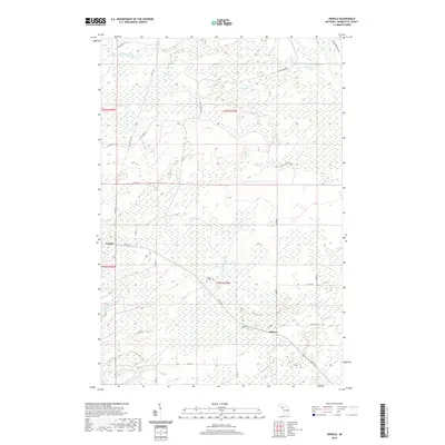
2019 Map of Arnold
USGS Topo · Published 2019About this map
Arnold and Watson anchor this portion of Wells Township, where the dense wetlands of the central Upper Peninsula define the pattern of human settlement and transport. The landscape is dominated by the complex drainage of the Little W Br Escanaba River to the north and the Ford River in the south, connected by a network of drainage systems including Lindsey Cr and Hunters Brook. The presence of the Forest Home Cem near the intersection of Co Rd 426 and Co Rd SZ provides a specific point of interest for genealogists tracing local families in this remote corner of Marquette County. Large stretches of the quadrangle remain dominated by marsh and brush, with the county highway system like Co Hwy 557 and numerous numbered roads such as Co Rd SA and Co Rd SU providing the primary access through the timber and wetland terrain.
Find a feature on this map
30 named features on this map. Tap any name to fly to it.
Don’t see what you’re looking for? This feature index may not catch every label — zoom into the map to look around manually.
Map Details
Editions of this 2019 Arnold Map
This is the sole edition of this map. No revisions or reprints were ever made.
Other maps of this area

1932 · Helena NW
USGS Topo · 1:31,680

1932 · Helena NE
USGS Topo · 1:31,680

1932 · Whitney NE
USGS Topo · 1:31,680

1932 · Helena SW
USGS Topo · 1:31,680

1932 · Helena
USGS Topo · 1:31,680

1951 · Helena SW
USGS Topo · 1:31,680

1951 · Helena
USGS Topo · 1:31,680

1951 · Helena NE
USGS Topo · 1:31,680

1951 · Helena NW
USGS Topo · 1:31,680

1954 · Escanaba
USGS Topo · 1:250,000