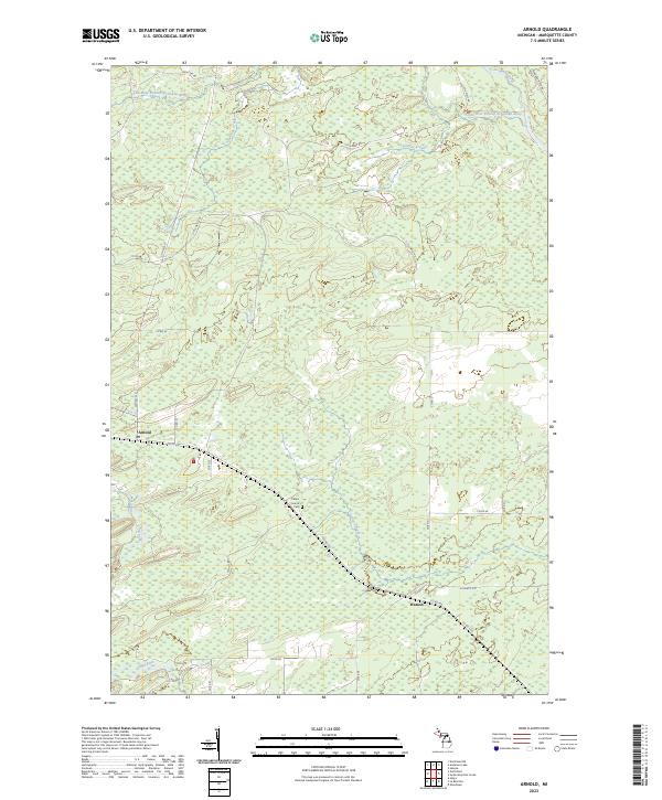
2023 Map of Arnold
USGS Topo · Published 2023About this map
Escanaba River and its Little West Branch Escanaba River dominate this portion of Marquette County, where the landscape is defined by the complex drainage systems of the Upper Peninsula. Small settlements like Arnold and Watson are linked by a network of county roads, including Co Hwy 557 and Co Rd 426, which cut through the dense hydrography of the region. The area's social history is anchored by the Po in Arnold and the Forest Home Cem, located centrally between the two primary communities.
Find a feature on this map
34 named features on this map. Tap any name to fly to it.
Don’t see what you’re looking for? This feature index may not catch every label — zoom into the map to look around manually.
Map Details
Editions of this 2023 Arnold Map
This is the sole edition of this map. No revisions or reprints were ever made.
Other maps of this area

1932 · Helena NW
USGS Topo · 1:31,680

1932 · Helena NE
USGS Topo · 1:31,680

1932 · Whitney NE
USGS Topo · 1:31,680

1932 · Helena SW
USGS Topo · 1:31,680

1932 · Helena
USGS Topo · 1:31,680

1951 · Helena SW
USGS Topo · 1:31,680

1951 · Helena
USGS Topo · 1:31,680

1951 · Helena NE
USGS Topo · 1:31,680

1951 · Helena NW
USGS Topo · 1:31,680

1954 · Escanaba
USGS Topo · 1:250,000