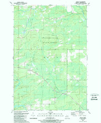
1989 Map of Arnold
USGS Topo · Published 1989About this map
Escanaba River State Forest dominates this section of the Upper Peninsula, where the timber and rail history of Wells township is clearly etched into the landscape. Small settlements like Arnold and Watson serve as focal points in an area defined by its watercourses and former industrial transport routes. The Little West Branch Escanaba River and Lindsey Creek wind through the northern reaches, while the southern edge is bordered by the Ford River.
Find a feature on this map
14 named features on this map. Tap any name to fly to it.
Don’t see what you’re looking for? This feature index may not catch every label — zoom into the map to look around manually.
Map Details
Editions of this 1989 Arnold Map
This is the sole edition of this map. No revisions or reprints were ever made.
Other maps of this area

1932 · Helena NW
USGS Topo · 1:31,680

1932 · Helena NE
USGS Topo · 1:31,680

1932 · Whitney NE
USGS Topo · 1:31,680

1932 · Helena SW
USGS Topo · 1:31,680

1932 · Helena
USGS Topo · 1:31,680

1951 · Helena SW
USGS Topo · 1:31,680

1951 · Helena
USGS Topo · 1:31,680

1951 · Helena NE
USGS Topo · 1:31,680

1951 · Helena NW
USGS Topo · 1:31,680

1954 · Escanaba
USGS Topo · 1:250,000