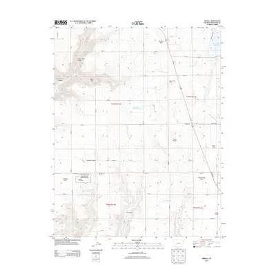
2013 Map of Arriola
USGS Topo · Published 2013About this map
Arriola serves as the focal point for this section of Montezuma County, where the high desert plateau is deeply etched by a network of drainage systems including Yellow Jacket Canyon and Crow Canyon. The agricultural character of the region is defined by an extensive irrigation infrastructure, featuring the Lone Pine Lateral and May Lateral which draw water toward the Narraguinnep Reservoir. Evidence of the area's ancient and modern significance is visible at Hovenweep National Monument, specifically the Goodman Point Group archaeological site located near Goodman Point. This intersection of history and utility is further marked by the proximity of the Goodman Point Cem and the Arriola Cem, providing essential locations for genealogical research. The landscape transition from open fields to the steep walls of Narraguinnep Canyon illustrates the complex topography that has shaped settlement patterns from ancestral times to the present day.
Find a feature on this map
42 named features on this map. Tap any name to fly to it.
Don’t see what you’re looking for? This feature index may not catch every label — zoom into the map to look around manually.
Map Details
Editions of this 2013 Arriola Map
This is the sole edition of this map. No revisions or reprints were ever made.
Other maps of this area

1956 · Cortez
USGS Topo · 1:250,000

1957 · Moqui SE
USGS Topo · 1:24,000

1958 · Cortez SW
USGS Topo · 1:24,000

1958 · Cortez
USGS Topo · 1:250,000

1959 · Cortez
USGS Topo · 1:250,000

1962 · Cortez
USGS Topo · 1:250,000

1965 · Woods Canyon
USGS Topo · 1:24,000

1965 · Cortez
USGS Topo · 1:24,000

1965 · Dolores West
USGS Topo · 1:24,000

1965 · Yellow Jacket
USGS Topo · 1:24,000