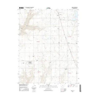
2016 Map of Arriola
USGS Topo · Published 2016About this map
Hoverweep National Monument and the prehistoric archaeological significance of Goodman Point anchor this high-plateau landscape in southwestern Colorado. The 2016 survey illustrates an intricate network of irrigation infrastructure essential to the high-altitude agriculture of Montezuma County, including the Lone Pine Lateral, Garret Ridge Lateral, and May Lateral. These watercourses connect various storage sites like Narraquinne Reservoir and the E G Merritt Reservoir to the surrounding fields.
Find a feature on this map
53 named features on this map. Tap any name to fly to it.
Don’t see what you’re looking for? This feature index may not catch every label — zoom into the map to look around manually.
Map Details
Editions of this 2016 Arriola Map
This is the sole edition of this map. No revisions or reprints were ever made.
Other maps of this area

1956 · Cortez
USGS Topo · 1:250,000

1957 · Moqui SE
USGS Topo · 1:24,000

1958 · Cortez SW
USGS Topo · 1:24,000

1958 · Cortez
USGS Topo · 1:250,000

1959 · Cortez
USGS Topo · 1:250,000

1962 · Cortez
USGS Topo · 1:250,000

1965 · Woods Canyon
USGS Topo · 1:24,000

1965 · Cortez
USGS Topo · 1:24,000

1965 · Dolores West
USGS Topo · 1:24,000

1965 · Yellow Jacket
USGS Topo · 1:24,000