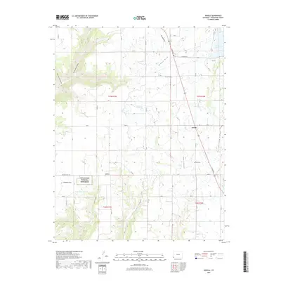
2019 Map of Arriola
USGS Topo · Published 2019About this map
Arriola and its surrounding high-desert agricultural landscape are defined by an intricate network of irrigation systems and deep canyons. Water management is central to this Montezuma County region, evidenced by the Lone Pine Lateral, Garret Ridge Lateral, and May Lateral which draw from reservoirs like the E G Merritt Reservoir and Narraquinne p Reservoir. These systems support the homesteads and fields that neighbor the natural draws of Dawson Draw and Brumley Draw.
Find a feature on this map
57 named features on this map. Tap any name to fly to it.
Don’t see what you’re looking for? This feature index may not catch every label — zoom into the map to look around manually.
Map Details
Editions of this 2019 Arriola Map
This is the sole edition of this map. No revisions or reprints were ever made.
Other maps of this area

1956 · Cortez
USGS Topo · 1:250,000

1957 · Moqui SE
USGS Topo · 1:24,000

1958 · Cortez SW
USGS Topo · 1:24,000

1958 · Cortez
USGS Topo · 1:250,000

1959 · Cortez
USGS Topo · 1:250,000

1962 · Cortez
USGS Topo · 1:250,000

1965 · Woods Canyon
USGS Topo · 1:24,000

1965 · Cortez
USGS Topo · 1:24,000

1965 · Dolores West
USGS Topo · 1:24,000

1965 · Yellow Jacket
USGS Topo · 1:24,000