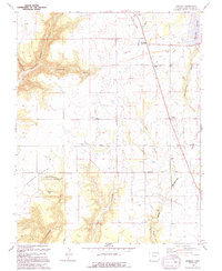
1994 Map of Arriola
USGS Topo · Published 1994About this map
Hovenweep National Monument Goodman Point Group anchors the southwestern portion of this landscape, preserving significant archaeological heritage amidst the high desert terrain. The area reflects a complex water management and agricultural history, evidenced by the extensive network of the Lone Pine Lateral and the Lone Pine Lateral Siphon, alongside the Narraguinnep Reservoir Spillway. Small settlements like Arriola and Lewis serve as local hubs, connected by the Arriola Road. Genealogical interest is found at the Goodman Point Cem and Arriola Cem, while the Lewis-Arriola Sch represents the shared civic life of these communities. The topography is defined by deep incisions such as Yellow Jacket Canyon and Goodman Canyon, where a Pack Trail winds through the land south of Goodman Lake.
Find a feature on this map
37 named features on this map. Tap any name to fly to it.
Don’t see what you’re looking for? This feature index may not catch every label — zoom into the map to look around manually.
Map Details
Editions of this 1994 Arriola Map
This is the sole edition of this map. No revisions or reprints were ever made.
Other maps of this area

1956 · Cortez
USGS Topo · 1:250,000

1957 · Moqui SE
USGS Topo · 1:24,000

1958 · Cortez SW
USGS Topo · 1:24,000

1958 · Cortez
USGS Topo · 1:250,000

1959 · Cortez
USGS Topo · 1:250,000

1962 · Cortez
USGS Topo · 1:250,000

1965 · Woods Canyon
USGS Topo · 1:24,000

1965 · Cortez
USGS Topo · 1:24,000

1965 · Dolores West
USGS Topo · 1:24,000

1965 · Yellow Jacket
USGS Topo · 1:24,000