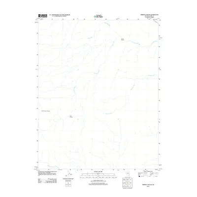
2012 Map of Arrow Canyon
USGS Topo · Published 2012About this map
Arrow Canyon and its associated range dominate this section of the Nevada desert within Clark County, showing an intricate drainage system typical of the arid Basin and Range province. This 2012 survey highlights the convergence of several ephemeral waterways, including Pahranagat Wash and the descriptive Side Canyon Wash, which carve through the stony landscape of the Arrow Canyon Range. The topography is defined by these dry washes and the prominent Side Canyon, which serve as the primary conduits for seasonal runoff. For the researcher or land historian, the map provides a precise look at the landforms in this part of the Mojave before further modern development, capturing landmarks like Battleship Wash and Hidden Wash in their natural state.
Find a feature on this map
7 named features on this map. Tap any name to fly to it.
Don’t see what you’re looking for? This feature index may not catch every label — zoom into the map to look around manually.
Map Details
Editions of this 2012 Arrow Canyon Map
This is the sole edition of this map. No revisions or reprints were ever made.
Other maps of this area

1886 · Saint Thomas
USGS Topo · 1:250,000

1893 · Saint Thomas
USGS Topo · 1:250,000

1954 · Las Vegas
USGS Topo · 1:250,000

1957 · Las Vegas
USGS Topo · 1:250,000

1958 · Arrow Canyon
USGS Topo · 1:62,500

1958 · Moapa
USGS Topo · 1:62,500

1959 · Las Vegas
USGS Topo · 1:250,000

1962 · Las Vegas
USGS Topo · 1:250,000

1969 · Farrier
USGS Topo · 1:24,000
1969 · Wildcat Wash SE
USGS Topo · 1:24,000