
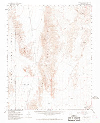
1958 Map of Arrow Canyon
USGS Topo · Published 1959About this map
Arrow Canyon Range and the Las Vegas Range dominate this late 1950s survey of the Nevada desert. The landscape is defined by vast depressions and arid basins, notably the Dry Lake (Alkali Flat) within Hidden Valley and the expansive Dry Lake Valley to the east. These geological features dictated the path of human infrastructure, as seen where the Union Pacific railroad skirts the southern edge of the mountains, connecting small outposts like Crystal and Ute.
Find a feature on this map
22 named features on this map. Tap any name to fly to it.
Don’t see what you’re looking for? This feature index may not catch every label — zoom into the map to look around manually.
Map Details
Editions of this 1958 Arrow Canyon Map
2 editions found
Other maps of this area

1886 · Saint Thomas
USGS Topo · 1:250,000

1893 · Saint Thomas
USGS Topo · 1:250,000

1907 · Las Vegas
USGS Topo · 1:250,000

1908 · Las Vegas
USGS Topo · 1:250,000

1926 · Boulder Canyon
USGS Topo · 1:96,000

1945 · Sheep Range
USGS Topo · 1:125,000

1952 · Gass Peak
USGS Topo · 1:62,500

1952 · Dry Lake
USGS Topo · 1:62,500

1953 · Muddy Peak
USGS Topo · 1:62,500

1954 · Las Vegas
USGS Topo · 1:250,000