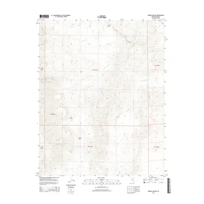
2014 Map of Arrow Canyon
USGS Topo · Published 2014About this map
Arrow Canyon Range dominates the western portion of this 2014 survey, marking a stark vertical presence above the surrounding basin. This area of the Mojave Desert is defined by a complex network of ephemeral drainage systems, most notably the winding course of Pahranagat Wash and the deeply incised Arrow Canyon. The landscape reveals a pattern of desert hydrology where runoff is channeled through seasonal arteries such as Side Canyon Wash and Battleship Wash. Evidence of modern infrastructure is sparse, limited primarily to Route 168 clipping the northeastern corner, leaving the vast majority of the quadrangle as an undisturbed study of Great Basin landforms and public land survey divisions.
Find a feature on this map
15 named features on this map. Tap any name to fly to it.
Don’t see what you’re looking for? This feature index may not catch every label — zoom into the map to look around manually.
Map Details
Editions of this 2014 Arrow Canyon Map
This is the sole edition of this map. No revisions or reprints were ever made.
Other maps of this area

1886 · Saint Thomas
USGS Topo · 1:250,000

1893 · Saint Thomas
USGS Topo · 1:250,000

1954 · Las Vegas
USGS Topo · 1:250,000

1957 · Las Vegas
USGS Topo · 1:250,000

1958 · Arrow Canyon
USGS Topo · 1:62,500

1958 · Moapa
USGS Topo · 1:62,500

1959 · Las Vegas
USGS Topo · 1:250,000

1962 · Las Vegas
USGS Topo · 1:250,000

1969 · Farrier
USGS Topo · 1:24,000
1969 · Wildcat Wash SE
USGS Topo · 1:24,000