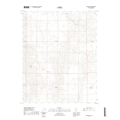
2018 Map of Arrow Canyon
USGS Topo · Published 2018About this map
The Arrow Canyon Range dominates the western topography of this arid Clark County landscape, where deep structural reliefs define the northern reaches of the Mojave Desert. This 2018 survey detail provides a look at the intricate network of dry drainage systems, including Arrow Canyon and its various tributaries that have carved through the limestone and dolomite formations over millennia. The map illustrates how seasonal water flow has shaped the environment, tracing the winding paths of Hidden Wash, Pahranagat Wash, and the notably named Battleship Wash. These features reflect the complex geomorphology of the region, where wide desert basins abruptly meet the steep, vertical walls of the Side Canyon. The absence of modern development highlights the preserved natural state of this terrain, making it a primary resource for studying desert hydrology and landform evolution.
Find a feature on this map
14 named features on this map. Tap any name to fly to it.
Don’t see what you’re looking for? This feature index may not catch every label — zoom into the map to look around manually.
Map Details
Editions of this 2018 Arrow Canyon Map
This is the sole edition of this map. No revisions or reprints were ever made.
Other maps of this area

1886 · Saint Thomas
USGS Topo · 1:250,000

1893 · Saint Thomas
USGS Topo · 1:250,000

1954 · Las Vegas
USGS Topo · 1:250,000

1957 · Las Vegas
USGS Topo · 1:250,000

1958 · Arrow Canyon
USGS Topo · 1:62,500

1958 · Moapa
USGS Topo · 1:62,500

1959 · Las Vegas
USGS Topo · 1:250,000

1962 · Las Vegas
USGS Topo · 1:250,000

1969 · Farrier
USGS Topo · 1:24,000
1969 · Wildcat Wash SE
USGS Topo · 1:24,000