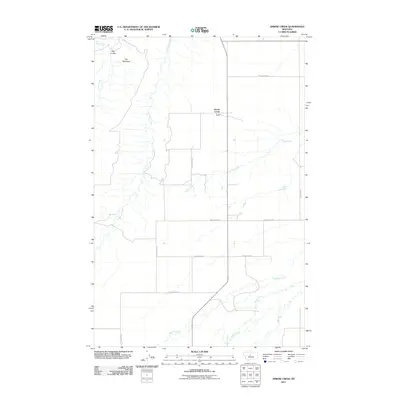
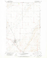
2011 Map of Arrow Creek
USGS Topo · Published 2011About this map
Arrow Creek and the surrounding plains of Judith Basin County are defined by a complex network of seasonal drainages and coulees. The landscape is dominated by the deeply etched terrain of The Badlands in the northwest, where Davis Creek and Big Coulee have carved into the high prairie. This 2011 survey illustrates how the local road network, including County Rd-214 and Dickson Rd, follows the section lines of the township and range system, occasionally deviating to cross the winding paths of Surprise Creek and Coffee Creek. Further south, the meandering courses of Meadow Creek and Wolf Creek underscore the importance of water management in this agricultural region, providing a detailed look at the drainage patterns that have shaped land use and property boundaries for generations of Montana ranchers.
Find a feature on this map
17 named features on this map. Tap any name to fly to it.
Don’t see what you’re looking for? This feature index may not catch every label — zoom into the map to look around manually.
Map Details
Editions of this 2011 Arrow Creek Map
This is the sole edition of this map. No revisions or reprints were ever made.
Other maps of this area

1890 · Fort Benton
USGS Topo · 1:250,000

1892 · Fort Benton
USGS Topo · 1:250,000

1897 · Fort Benton
USGS Topo · 1:250,000

1954 · Great Falls
USGS Topo · 1:250,000

1957 · Great Falls
USGS Topo · 1:250,000
1978 · Stanford NE
USGS Topo · 1:24,000
1978 · Strouf Island
USGS Topo · 1:24,000

1978 · Leiberg Coulee
USGS Topo · 1:24,000
1978 · Merino
USGS Topo · 1:24,000
1978 · Stanford
USGS Topo · 1:24,000